Montana State Library’s Cadastral Application Launches User-Friendly Redesign
(HELENA)—The Montana Cadastral application (gis.mt.gov) is heavily used by Montanans across the state as their source for land ownership information. Citizens, industries, and government entities use this map-based application to search for property information by geocode, owner, address, assessment code, subdivision, or by location on the map.
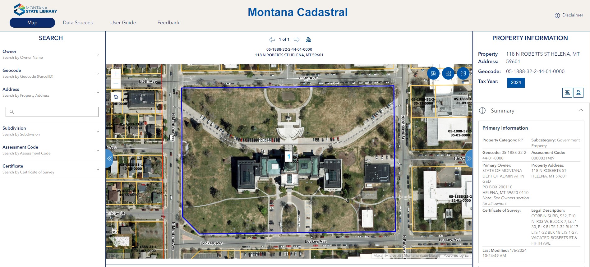
On April 3rd, the Montana State Library (MSL) released a new version of the Montana Cadastral application. This redesign is a complete rewrite with significant changes “under the hood.” With the redesign, the application is mobile device friendly with improved performance for phone and tablet access. The upgraded print feature creates an improved PDF report of the property information.
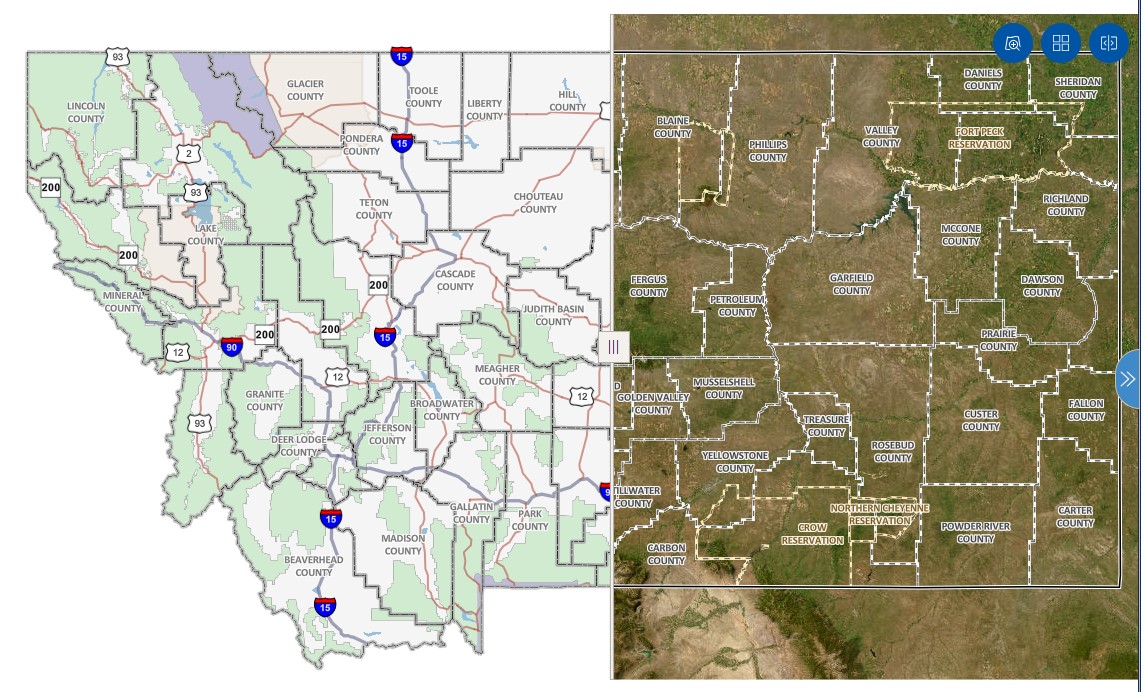
The redesign also enhances map performance in the application. The user can quickly zoom in on counties, cities, reservations, townships, ranges, and sections. Once zoomed in, parcels can be selected by rectangle, polygon, or buffer. The redesign improves the experience of browsing through multiple selected parcels. For realtors, this upgrade allows for easily browsing through properties in a neighborhood to view comparable properties.
The Montana Cadastral offers a variety of options for the basemap in its Basemap Gallery, such as topographical, terrain, or aerial imagery by odd year going back to 2005. In the redesign, the user can use the basemap swipe tool to drag the tool between two different basemaps. With this new tool, a user can easily see historic changes to a property.
MSL is encouraging Montana Cadastral users to provide feedback on the updated application. Select the “Feedback” tab at the top of the homepage. Our team of GIS professionals appreciates hearing any questions, comments, or concerns that you have about the application.
The Montana Cadastral is maintained through a partnership between the MSL and the Montana Department of Revenue. The Department of Revenue maintains the data displayed in Property Information in the Montana Cadastral. MSL created the Montana Cadastral to make Montana’s property information easily accessible to all.
The Montana State Library (MSL) provides information, resources, and guidance to organizations, communities, and residents of Montana to help them expand their knowledge and empower their decisions. Our leading-edge data and applications help those seeking answers about Montana’s government, natural resources, heritage, land ownership, and more while our vital services improve public libraries and provide reading materials to those with disabilities. For more information, visit msl.mt.gov.